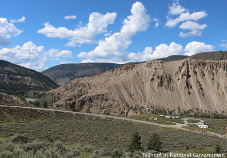
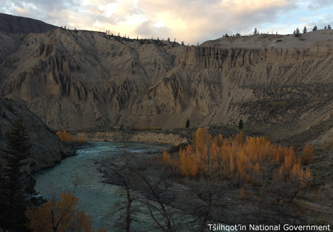
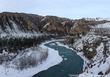
Farwell Canyon
| Language of origin | English language |
| Feature Type: | Canyon (2) - Deep, narrow valley with precipitous walls. |
| Status: | Official |
| Other Names: | Nagwentled |
| Name Authority: | BC Geographical Names Office |
| Relative Location: | Along Chilcotin River, between Big Creek and Fraser River, Lillooet Land District |
| Latitude-Longitude: | 51°49'59"N, 122°33'58"W at the approximate centre of this feature. |
| Datum: | WGS84 |
| NTS Map: | 92O/15 |
|
Origin Notes and History:
|
Adopted 5 August 1954 on 92 O; a local name, as identified in dominion topographical survey field lists by B.L. Anderson. Source: BC place name cards, correspondence and/or research by BC Chief Geographer & Geographical Names Office staff. |
|
The waterfall in this canyon were known at one time as "Chilcotin Falls" according to notation on BC name card - now known as Farwell Rapids. Source: BC place name cards, or correspondence to/from BC's Chief Geographer or BC Geographical Names Office |
|
The Tŝilhqot’in name for this canyon is Nagwentled. (Advice from Tŝilhqot’in National Government 2018) Source: BC place name cards & correspondence, and/or research by BC Chief Geographer & Geographical Names Office staff. |