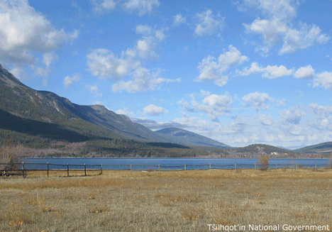
| Feature Type: | Lake - Inland body of standing water. |
| Status: | Not official |
| Other Names: | Telhiqox BinyOfficial |
| Relative Location: | S of Tatla Lake, N of the Homathko Icefield, Range 2 Coast Land District |
| Latitude-Longitude: | 51°32'46"N, 124°24'52"W at the approximate centre of this feature. |
| Datum: | WGS84 |
| NTS Map: | 92N/9 |
| Related Maps: |
92N/8 92N/9 |
|
Origin Notes and History:
|
Tatlayoko Lake adopted 26 June 1911; not "Tatlahco" as spelled on Trutch's 1871 map of British Columbia, nor "Tatlayoco" as spelled on subsequent maps. An established local name. Name changed 11 March 2019 to Telhiqox Biny as recommended by Tŝilhqot’in National Government, as Telhiqox Biny is the Tŝilhqot’in name for this lake and supported by the Cariboo Regional District, BC Parks, and Recreation Sites and Trails. Source: BC place name cards, or correspondence to/from BC's Chief Geographer or BC Geographical Names Office |
|
Scene of mineral prospecting (1911). Source: Canadian Geographical Names Database, Ottawa |
|
Identified as Tatlayoko Lake in The Nemiah Declaration, 23 August 1989, by the Tsilhqot'in People of Xeni, a.k.a. Nemiah Valley Indian Band. Traditional name and spelling identified as Talhiqox Biny (where biny means "lake") in land claims maps filed 2004-05. Source: BC place name cards, or correspondence to/from BC's Chief Geographer or BC Geographical Names Office |