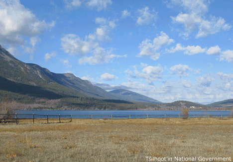
| Feature Type: | Lake - Inland body of standing water. |
| Status: | Official |
| Name Authority: | BC Geographical Names Office |
| Pronounced: | Tell-hee-koh Bee |
| Relative Location: | S of Tatla Lake, N of the Homathko Icefield, Range 2 Coast Land District |
| Latitude-Longitude: | 51°32'46"N, 124°24'52"W at the approximate centre of this feature. |
| Datum: | WGS84 |
| NTS Map: | 92N/9 |
| Related Maps: |
92N/8 92N/9 |
|
Origin Notes and History:
|
Tatlayoko Lake adopted 26 June 1911; not "Tatlahco" as spelled on Trutch's 1871 map of British Columbia, nor "Tatlayoco" as spelled on subsequent maps. An established local name. The name "Tatlayoko" is an anglicization of "Telhiqox." Name changed 11 March 2019 to Telhiqox Biny as recommended by Tŝilhqot’in National Government, as Telhiqox Biny is the Tŝilhqot’in name for this lake and supported by the Cariboo Regional District, BC Parks, and Recreation Sites and Trails. Source: BC place name cards & correspondence, and/or research by BC Chief Geographer & Geographical Names Office staff. |
|
Tŝilhqot’in name meaning 'lake of Telhiqox.' The name "Telhiqox" has been in use for so long that a direct translation to English is difficult. It is considered a proper noun and opinions vary on its origin (Advice from the Tŝilhqot’in National Government, 2018). Source: BC place name cards & correspondence, and/or research by BC Chief Geographer & Geographical Names Office staff. |
|
Often simply called "Telhiqox" which refers to this lake as well as the wider locality around the lake, as is common in Tŝilhqot’in toponymy. "Telhiqox Biny" refers more specifically to the lake itself (Advice from the Tŝilhqot’in National Government, 2018). Source: BC place name cards & correspondence, and/or research by BC Chief Geographer & Geographical Names Office staff. |
|
Sometimes spelled/pronounced "Talhiqox" (Advice from the Tŝilhqot’in National Government, 2018). Source: BC place name cards & correspondence, and/or research by BC Chief Geographer & Geographical Names Office staff. |