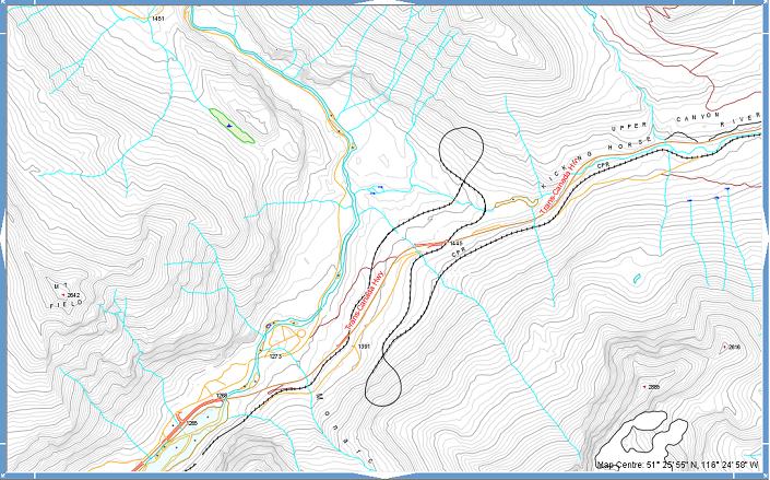
Spiral Tunnels
| Language of origin | English language |
| Feature Type: | Tunnel - Underground passageway for a travel route (under a watercourse or arm of the sea, or through an elevation of terrain). |
| Status: | Official |
| Name Authority: | BC Geographical Names Office |
| Relative Location: | On CPR between Kicking Horse Pass and Field, in Yoho National Park, Kootenay Land District |
| Latitude-Longitude: | 51°25'47"N, 116°24'36"W at the approximate centre of this feature. |
| Datum: | WGS84 |
| NTS Map: | 82N/8 |
|
Origin Notes and History:
|
Adopted by British Columbia 2 June 1994 on 82 N/8; adopted by Parks Canada 21 September 1995. Source: BC place name cards, correspondence and/or research by BC Chief Geographer & Geographical Names Office staff. |