| Language of origin | Wakashan language family Nuu-chah-nulth language |
| Feature Type: | Creek (1) - Watercourse, usually smaller than a river. |
| Status: | Official |
| Other Names: | Uchuck Creek |
| Name Authority: | BC Geographical Names Office |
| Relative Location: | Flows SE from Uchuck Lake into head of Uchucklesit Inlet, N side of lower Alberni Inlet, Clayoquot Land District |
| Tags: | Indigenous |
| Latitude-Longitude: | 49°00'53"N, 125°03'06"W at the approximate mouth of this feature. |
| Datum: | WGS84 |
| NTS Map: | 92F/3 |
|
Origin Notes and History:
|
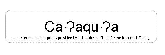
Uchuck Creek adopted 3 December 1946 as labelled on BC Lands' map 2A, 1938, in association with Uchucklesit Inlet. Name changed to Ca'aqu'a Creek 1 April 2011, per the provisions of the Maa-nulth Treaty. An image of the written name shows the preferred orthography. Source: BC place name cards, files, correspondence and/or research by BC Chief Geographer/Geographical Names Office. |
|
Ca·?aqu·?a means "swift or moving water" [where ca-aq means swift.] (Uchucklesaht Tribe Communications Coordinator, October 2008). The creek is also commonly called Silver Creek, and this stretch of shoreline is known as Silverside. (Uchucklesaht Tribe, December 2010). Source: included with note |
|
The Uchucklesaht name for the mouth of this creek, and possibly extending along the north shore of Daller Point, is Taski·ha?a, meaning "slippery rocks" - a sacred and spiritual area for the Uchucklesaht Tribe (Uchucklesaht Tribe, December 2010). The common names Silver Creek and Silverside are likely a reference to the appearance of the slippery rocks here. Source: included with note |