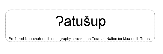
Atushuup
[atoosh oop]
| Language of origin | Wakashan language family Nuu-chah-nulth language |
| Feature Type: | Point - Land area jutting into a water feature; also used for a convex change in direction of a shoreline. |
| Status: | Not official |
| Other Names: | Lyall PointOfficial |
| Relative Location: | E side of David Channel, N of Broken Group in Barkley Sound, Clayoquot Land District |
| Tags: | Indigenous |
| Latitude-Longitude: | 48°58'09"N, 125°19'23"W at the approximate centre of this feature. |
| Datum: | WGS84 |
| NTS Map: | 92C/14 |
|
Origin Notes and History:
|
Atushuup is the traditional name of Lyall Point or the entire peninsula behind Lyall Point. Source: BC place name cards, files, correspondence and/or research by BC Chief Geographer/Geographical Names Office. |
|
The peninsula behind Lyall Point is a boundary between the traditional territories of Toquaht, Huu-ay-aht and Tseshaht First Nations, and the location of a important Toquaht heritage site. "Atushuup means standing deer point, where atush means deer." (advice from Toquaht Elder Anne Mack, shared November 2010) Source: included with note |