| Language of origin | Wakashan language family Nuu-chah-nulth language |
| Feature Type: | River - Watercourse of variable size, which has tributaries and flows into a body of water or a larger watercourse. |
| Status: | Official |
| Name Authority: | BC Geographical Names Office |
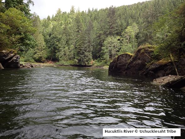
| Relative Location: | Drains Hucuktlis Lake into Uchucklesit Inlet, N side of lower Alberni Inlet, Clayoquot Land District |
| Tags: | Indigenous |
| Latitude-Longitude: | 49°01'14"N, 125°02'33"W at the approximate mouth of this feature. |
| Datum: | WGS84 |
| NTS Map: | 92F/3 |
|
Origin Notes and History:
|
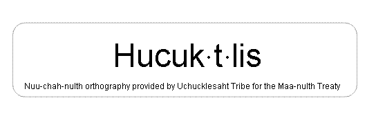
Hucuktlis River adopted 1 April 2011, per the provisions of the Maa'nulth Treaty. An image of the written name shows the preferred orthography. Source: BC place name cards, files, correspondence and/or research by BC Chief Geographer/Geographical Names Office. |
|
Members of Uchucklesaht Tribe living at Hi'tatis (formerly Elhlateese IR 2) have been calling this 1km-long channel "Henderson River" because it drains Henderson Lake; however, because the traditional name of Henderson Lake is Hucuktlis, the Elhlateese residents are now being encouraged by Uchucklesaht Tribe Elders to call this Hucuktlis River. Note that this is not the ancient name - the original name, now forgotten, referred to [the presence of] "sea mermaids" or elephant seals. (advice from Uchucklesaht Tribe, December 2010) Source: included with note |
|
"Uchucklesaht Tribe membership traditionally used and protected this river for centuries. Many Uchucklesaht people come to this river to play and to complete their sacred ceremonies." (Uchucklesaht Tribe, September 2010) Source: included with note |