| Language of origin | Tsimshianic language family Nisg̲a’a language |
| Feature Type: | Bay - Water area in an indentation of the shoreline of a sea, lake, or large river. |
| Status: | Official |
| Other Names: | Fishery Bay |
| Name Authority: | BC Geographical Names Office |
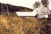
| Relative Location: | N side lower Nass River, below Laxgalts'ap (formerly Greenville), N of Prince Rupert, Range 5 Coast Land District |
| Tags: | Indigenous |
| Latitude-Longitude: | 55°00'04"N, 129°38'25"W at the approximate centre of this feature. |
| Datum: | WGS84 |
| NTS Map: | 103P/4 |
|
Origin Notes and History:
|
Fishery Bay adopted 25 September 1974 on 103 P, as identified in Report of Royal Commission on Indian Affairs, 1916, p.567, and labelled on subsequent maps. Name changed to Ts'im K'ol'hl Da oots'ip per the Nisga'a Treaty, Appendix F-3, effective 11 May 2000. Source: BC place name cards, or correspondence to/from BC's Chief Geographer or BC Geographical Names Office |
|
Ts'imk'olhl Da'oots'ip [spelling provided by Ayuukl Nisga'a Department, October 1997] means "behind the fortress". The name refers to the bay, an old village and an oolichan fishing site. Source: Nisga'a Tribal Council / Ayuukhl Nisga'a Department, Aiyansh BC |
|
There was a huge rock here which was utilized as a defense against raiding parties. Hence Ts'imk'olhl Da'oots'ip is the place where the Nisga'a retreated for protection during times of such raids and wars at the Nass estuary. Ts'im K'ol'hl Da oots'ip is the site as well where the Nisga'a gathered annually in the spring for oolichan harvest and grease-making. It is said that thousands gathered here at one time as the Nisga'a permitted other Nations (Ts'imsan, Gidagans, Gitksan and Haida) to harvest oolichan, but most particularly to conduct their trading activities, the oolichan grease being the staple product of the Nisga'a. Prior to such trading activities, formal agreements were made between the Nisga'a Sim'oogit/ chiefs, and visiting Nations. Up until the early 1900's, such agreements were still being honoured. Source: Nisga'a Tribal Council / Ayuukhl Nisga'a Department, Aiyansh BC |