| Language of origin | Athabaskan-Eyak-Tlingit, Na-Dene language family |
| Feature Type: | Lakes - Inland body of standing water. Plural of Lake. |
| Status: | Official |
| Other Names: | Dasiqox Biny (Taseko Lakes), Dasiqox Biny |
| Name Authority: | BC Geographical Names Office |
| Relative Location: | E of Tŝilhqox Biny (lake), SW of Williams Lake (city), Lillooet Land District |
| Tags: | Indigenous |
| Latitude-Longitude: | 51°15'09"N, 123°35'26"W at the approximate centre of this feature. |
| Datum: | WGS84 |
| NTS Map: | 92O/5 |
| Related Maps: |
92O/4 92O/5 |
|
Origin Notes and History:
|
Taseko Lakes (not Taseco) adopted in the 10th Report of the Geographic Board of Canada, 30 June 1911. Source: BC place name cards, or correspondence to/from BC's Chief Geographer or BC Geographical Names Office |
|
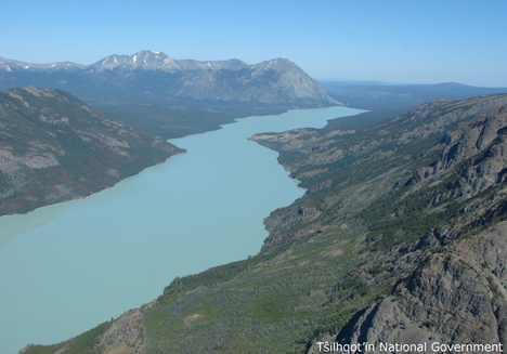
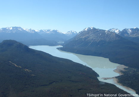
Together the lakes are known as Taseko Lakes; individually, the northern lake is called Lower Taseko Lake and the southern lake is called Upper Taseko Lake. The individual names were adopted 5 August 1954 on 92O. Source: BC place name cards, or correspondence to/from BC's Chief Geographer or BC Geographical Names Office |
|
"Dasiqox Biny" is a Tŝilhqot’in name meaning “lake of Dasiqox” where Dasiqox is the Tŝilhqot’in name for Taseko River, and "biny" means “lake.” Dasiqox is a proper noun, having been in use for so long that a direct English translation is difficult. The suffix "-qox" means “river (yeqox)” but "Dasi-" has no direct translation. Opinions vary on its origin (advice from Tŝilhqot’in National Government, 2018). Source: included with note |
|
"[Taseko River] from a Chilcotin Indian word that means "mosquito river." Source: Akrigg, Helen B. and Akrigg, G.P.V; British Columbia Place Names; Sono Nis Press, Victoria 1986 /or University of British Columbia Press 1997 |
|
"The Chilcotin name for Taseko Lake is dasiqox.... The name for Taseko narrows [between Upper and Lower Taseko Lakes] is nanats'akash - an important crossing place for dear." (from an interview with Henry Solomon, Nemaiah Valley, about place names and resources in the Nemaiah Valley-Taseko Lakes-Yohetta Valley area, conducted by Robert Tynhurst, 24 July 1983). Identified as Taseko Lake in The Nemiah Declaration, 23 August 1989, by the Tsilqot'in People of Xeni, a.k.a. Nemiah Valley Indian Band. Traditional spelling identified as Dasiqox Biny (where biny means "lake") in land claims maps filed 2004-05. Source: BC place name cards, or correspondence to/from BC's Chief Geographer or BC Geographical Names Office |