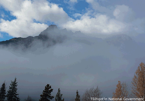
| Feature Type: | Mountain - Mass of land prominently elevated above the surrounding terrain, bounded by steep slopes and rising to a summit and/or peaks. |
| Status: | Not official |
| Other Names: | ʔEniyudOfficial |
| Relative Location: | Just E of the N end of Telhiqox Biny (lake) and N of the Homathko Icefield, Range 2 Coast Land District |
| Latitude-Longitude: | 51°38'21"N, 124°31'31"W at the approximate centre of this feature. |
| Datum: | WGS84 |
| NTS Map: | 92N/10 |
|
Origin Notes and History:
|
Niut Mountain adopted 5 October 1960 on 92N. Name changed to ʔEniyud 11 June 2020 on 92N/10 as recommended by the Tŝilhqot'in National Government as this is the Tŝilhqot'in name for this mountain and supported by Cariboo Regional District, Rec Sites and Trails BC, the Cariboo Mountain Bike Consortium, Avalanche Canada, BC Mountaineering Club and the Association of Canadian Mountain Guides. Source: BC place name cards, files, correspondence and/or research by BC Chief Geographer/Geographical Names Office. |
|
'Niut' is an anglicization of "ʔEniyud." Sometimes spelled "ʔUniyud' (Advice from Tŝilhqot’in National Government 2018). See name record for "ʔEniyud," the Tŝilhqot’in name for Niut Mountain, for more information on the name origin. Source: BC place name cards & correspondence, and/or research by BC Chief Geographer & Geographical Names Office staff. |