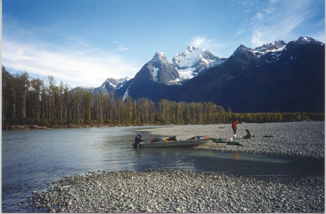
Tulsequah River
| Language of origin | Athabaskan-Eyak-Tlingit, Na-Dene language family Tlingit language |
| Feature Type: | River - Watercourse of variable size, which has tributaries and flows into a body of water or a larger watercourse. |
| Status: | Not official |
| Other Names: | Talsekwe River, Taaltsux̱éi Héen Official |
| Relative Location: | Flows SE. into Taku River, Cassiar Land District |
| Tags: | Indigenous |
| Latitude-Longitude: | 58°37'42"N, 133°33'11"W at the approximate mouth of this feature. |
| Datum: | WGS84 |
| NTS Map: | 104K/12 |
| Related Maps: |
104K 104K/12 104K/13 |
|
Origin Notes and History:
|
"Tulsequah River" adopted July 10, 1945 by Executive Committee on Board file 0705 on 104/NW. Taaltsux̱éi Héen made the official name 28 July 2023 on 104K/12, as requested by Taku River Tlingit First Nation. Taaltsux̱éi Héen is the traditional and ancestral Tlingit name (advice from Taku River Tlingit, 2016). Source: BC place name cards & correspondence, and/or research by BC Chief Geographer & Geographical Names Office staff. |
|
May have previously appeared as Tallsaykway, Taltakay, Tolusque, or Talswekwe Creek (1924 Gazetteer). Source: BC place name cards & correspondence, and/or research by BC Chief Geographer & Geographical Names Office staff. |
|
Headwaters at 5850 - 133 43. Source: Canadian Geographical Names Database, Ottawa |